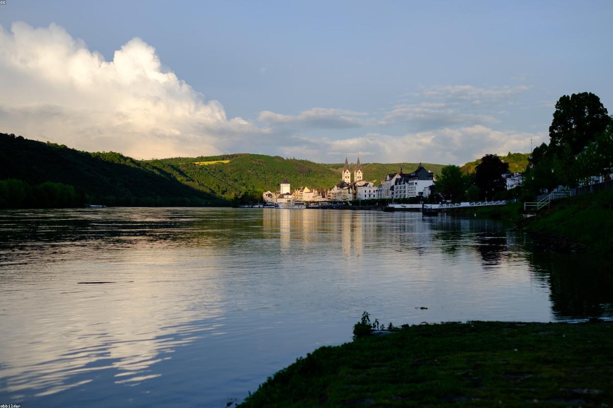
Categories
Uncategorized

Planning a Trip Into Gwaii Haanas National Park Reserve

The southern third of Haida Gwaii is set aside as Gwaii Haanas National Park Reserve, National Marine Conservation Area Reserve, and Haida Heritage Site, a long official name that hints at how unusual this place is. There are no roads here, no lodges, and no marked trails once you step away from the shoreline. Everything below the midpoint of Moresby Island, all the way south to the ancient village of SGang Gwaay, can be reached only by boat or floatplane. That remoteness is exactly why the old mortuary poles, the mossy old-growth rainforest, and the vast seabird colonies are still intact. It is also why a visit here asks more of you, in planning and patience, than almost anywhere else on the British Columbia coast.

A protected place shaped by two governments

Gwaii Haanas is not managed like an ordinary national park. It is co-managed by Parks Canada and the Council of the Haida Nation through a body called the Archipelago Management Board, where decisions are made together rather than by one authority overruling the other. This arrangement grew out of the stand-off at Lyell Island in 1985, when Haida elders blockaded logging roads to stop clear-cutting in the south. The result is a place where conservation and Haida cultural survival are treated as the same goal.

For a visitor, the practical consequence is that you are entering both a wilderness and a homeland. The islands you paddle past hold burial caves, house pits, and standing poles that are still meaningful to living families. Understanding that context before you arrive changes how you move through the place, and it is the reason the trip requires a little formality at the start.

Reservations and the mandatory orientation

You cannot simply show up and launch a kayak into Gwaii Haanas. Everyone travelling in the reserve must hold a reservation and complete an orientation session before departing. The orientation is not a formality to rush through. It covers safety on exposed water, low-impact camping, how to behave at cultural sites, and the current condition of anchorages and landing spots. Independent travellers usually attend an in-person session in Daajing Giids or Sandspit, while guided guests are briefed by their operator.

A few things are worth knowing well in advance:

  • Daily entry is capped, so popular dates fill early. Reserve as soon as your dates are firm, ideally months ahead for the summer window.
  • A separate standby pool exists for travellers who did not book ahead, but relying on it is a gamble in July and August.
  • User fees apply per person per day, and they support the Watchmen program and site maintenance.
  • Children and youth are often free or discounted, but the orientation requirement still applies to the group.

Budget a full extra day at the front of your itinerary for the orientation and for staging gear. Weather on Hecate Strait and around Cape St. James can delay boats and planes, and having slack in the schedule keeps a delay from wrecking the whole trip.

The Haida Gwaii Watchmen and the sites they guard

The heart of a Gwaii Haanas trip is the network of ancestral village sites cared for by the Haida Gwaii Watchmen. From roughly May to September, Haida people live at these locations, welcome visitors, share stories, and make sure the sites are treated with respect. You do not wander into a village unannounced; you land, check in, and are guided.

The best known stops include:

  • SGang Gwaay, a UNESCO World Heritage Site on Anthony Island, where a line of weathered mortuary and memorial poles faces the sea. It is one of the most powerful cultural landscapes in Canada.
  • T’aanuu Llnagaay and K’uuna Llnagaay, older village sites where fallen poles and house depressions are slowly returning to the forest floor.
  • Hlk’yah GawGa at Windy Bay, home to the Gwaii Haanas Legacy Pole raised in 2013, the first monumental pole carved in the area in well over a century.
  • Gandll K’in Gwaay.yaay, Hotspring Island, where geothermal pools that ran dry after the 2012 earthquake have gradually returned.

An important point of etiquette: the poles are left to decay naturally rather than being restored or propped up. Do not touch them, lean on them, or step over fallen ones. Photography of the sites is generally welcome, but ask before photographing the Watchmen themselves.

Deciding how you will actually travel

There are three realistic ways to experience Gwaii Haanas, and they suit very different travellers. Sea kayaking is the classic immersive option, letting you move quietly among islets and camp on remote beaches, but it demands genuine experience with cold, exposed, tidal water and multi-day self-sufficiency. This is not a place for a first paddling trip.

Guided mothership and Zodiac tours are the most comfortable choice for most visitors. You sleep and eat aboard a vessel and make daily landings, covering far more ground than a kayak could and leaning on guides who know the anchorages and the weather. Floatplane day trips from Sandspit are the fastest way to see a marquee site such as SGang Gwaay if your time is short, though you trade the slow intimacy of the water for speed.

Packing for a place with no services

Once you leave town there are no shops, no reliable cell coverage, and no quick rescue. Self-sufficiency is the rule. Beyond the obvious camping and cooking gear, plan for cool, wet conditions even in midsummer.

  • Full rain gear and layers; the rainforest earns its name and mornings are often grey and damp.
  • Rubber boots for wet landings and slippery intertidal rock.
  • A dry bag system so that a capsize or a downpour does not soak your sleeping gear.
  • Extra food beyond your planned days, because weather can strand you.
  • A means of emergency communication such as a satellite messenger, since phones will not help you.

Choosing your season and setting expectations

The visitor season runs roughly from May into September, with the Watchmen sites staffed during those months. Early summer tends to be a little drier and buggier ashore; late summer can bring settled spells but also the first autumn systems. Whenever you go, expect changeable weather and build flexibility into every day. A trip into Gwaii Haanas rewards travellers who arrive prepared, unhurried, and ready to be moved by what they find, an intact stretch of coast where forest, sea, and Haida history have never been separated.

Categories
Uncategorized

The Living Culture Behind Haida Gwaii’s Totem Poles

Visitors often arrive on Haida Gwaii expecting totem poles to be relics, quiet remnants of a vanished world. They are not. The poles standing at village sites, in Skidegate, and outside the longhouses are threads of a culture that was suppressed but never broken, and that is now visibly resurgent. To read a Haida pole well is to understand something about family, law, and belonging on these islands, not just to admire the carving. This guide is an introduction to what the poles mean and how to visit the places that hold them with genuine respect.

Reading a pole: crests, moieties, and story

Haida society is divided into two great halves, or moieties, known as Raven and Eagle. Every person belongs to one, inherited through the mother, and marriage traditionally crossed the two. Within each moiety are lineages that hold rights to particular crests, the animals and beings you see stacked on a pole. A crest is not decoration; it is closer to a family’s inherited property, a visual record of who someone is and which stories, songs, and territories they are entitled to.

Common figures include Raven, Eagle, Killer Whale, Grizzly Bear, Dogfish, Frog, Beaver, and the wide-eyed Watchmen figures that sit at the top of some poles. Reading a pole is less about a bottom-to-top narrative sequence, a popular myth, and more about recognizing which crests are present and understanding the family history they announce. A knowledgeable Haida guide can tell you what a given arrangement declares about the lineage that raised it.

Why the poles are not all the same

The word totem pole flattens several very different objects into one. On Haida Gwaii you will encounter distinct kinds, each with its own purpose:

  • Mortuary poles, which held the remains of a high-ranking person in a box at the top. The famous line of poles at SGang Gwaay includes many of these.
  • Memorial poles, raised to honour a person or mark a succession of leadership.
  • House frontal poles, set against the front of a longhouse, sometimes with an oval opening that served as the doorway.
  • Welcome poles and, in the modern era, legacy poles raised to mark significant events, such as the pole raised at Windy Bay in 2013 to commemorate the protection of Gwaii Haanas.

At the old village sites, the poles are deliberately left to weather and eventually fall. In Haida understanding, a pole has a life; when it returns to the earth, that is part of its story, not a failure to preserve it. This is why you should never touch, climb, or reposition a fallen pole.

The Haida Heritage Centre at Kay Llnagaay

If you visit only one cultural site on the islands, make it the Haida Heritage Centre at Kay Llnagaay, on the shore at Skidegate. Built as a row of cedar longhouses facing the water, fronted by a line of monumental poles, it is both a museum and a working cultural hub. Inside you will find the Haida Gwaii Museum’s collections, a carving shed where you may see artists at work, and canoes including craft in the tradition of Loo Taas, the great cedar canoe carved under Bill Reid for Expo 86 that was paddled home to Haida Gwaii.

The Centre is the right first stop because it gives you the framework, language, protocol, and history, that makes everything else you see on the islands legible. Time your visit for one of the interpretive talks or performances if you can, and give yourself at least a couple of hours.

The arts beyond the poles

Monumental carving is only the most visible Haida art form. Several others are unique to these islands or reached their highest expression here:

  • Argillite carving, worked from a soft black slate quarried at a single site on Slatechuck Mountain near Daajing Giids. Argillite is found nowhere else in the world in this form, and Haida carvers turn it into miniature poles, platters, and figures. Buying argillite directly from Haida artists supports the tradition.
  • Weaving in spruce root and cedar bark, producing the finely made hats, baskets, and regalia seen at ceremonies.
  • Button blankets and appliqué robes that display a wearer’s crests in trade cloth and shell buttons.
  • Jewellery engraved in silver and gold, a lineage of design that Bill Reid helped bring to wide attention in the twentieth century.

Visiting with respect

Haida culture is not a backdrop for a holiday; it belongs to a living nation on its own land. A few practices go a long way toward being a welcome guest. At the Watchmen-guarded village sites, follow your host’s direction and do not stray into areas that are off limits. Ask before photographing people. Do not collect anything, not a shell fragment, a pole splinter, or a stone, from a cultural site. When you buy art, buy from Haida makers and be wary of mass-produced imitations sold as authentic.

It also helps to learn a little of the story of suppression. The Canadian potlatch ban, in force from 1885 until 1951, criminalized the ceremonies through which crests, names, and histories were formally transmitted. Combined with the devastation of smallpox in the nineteenth century, which emptied villages such as those you now visit as ruins, this came close to severing the culture entirely. That it survived is a testament to families who kept practices alive quietly through those decades.

A name reclaimed

The change from Queen Charlotte Islands to Haida Gwaii, meaning islands of the people, was formalized in 2010 as part of a reconciliation agreement between the Haida Nation and the Province of British Columbia. In 2022 the largest town shed its colonial name and became Daajing Giids. These are not cosmetic gestures. They are markers of a broader resurgence, of language revival, of new poles being raised, of young carvers and weavers learning from elders. To pay attention to the poles of Haida Gwaii is to watch a culture not merely remembered but actively rebuilt, and to be trusted as a visitor is a privilege worth honouring.

Categories
Uncategorized

Where to Watch Wildlife and Seabirds on Haida Gwaii

Haida Gwaii is sometimes called the Galapagos of the North, and the nickname is more than tourist-brochure enthusiasm. Isolated from the mainland by the wide, stormy waters of Hecate Strait since the last ice age, the archipelago has evolved its own distinct animals and hosts globally significant colonies of nesting seabirds. It is also a place of striking absences, where familiar mainland predators simply never arrived. For a naturalist, that combination of endemic life, huge bird numbers, and an unusual food web makes the islands one of the most rewarding wildlife destinations on the Pacific coast.

The islands’ unusual mammals

The animal most visitors hope to see is the Haida Gwaii black bear, a subspecies found only here. It is the largest black bear in North America, with a noticeably bigger skull and heavier molars than its mainland relatives, adaptations for crushing the shellfish, crabs, and intertidal food it forages along the shoreline at low tide. Watching a bear turn over rocks on a beach at dusk is a common and memorable sight, particularly along quieter stretches of Graham Island.

Other native mammals also diverged into island forms, including a distinct pine marten, an ermine, and a dusky shrew. Just as telling is what is missing. There are no wolves, no grizzlies, no cougars, and no moose that walked here on their own. That absence of large predators shaped everything else, including the behaviour of the bears and the vulnerability of ground-nesting birds.

Some of the most consequential animals, unfortunately, were brought by people. Sitka black-tailed deer, introduced more than a century ago, exploded without predators and have stripped the forest understory bare across much of the islands, a slow ecological disaster you can read in the browse line of the woods. Introduced raccoons and rats prey heavily on seabird eggs and chicks, which is why intensive rat-eradication projects have been carried out on several small islands to give the burrow-nesting birds a chance to recover.

Seabirds and the significance of the colonies

The offshore islets of Haida Gwaii are one of the great seabird strongholds of the North Pacific. Millions of birds nest here, many in burrows they dig into the soft forest soil of predator-free islands. The archipelago supports a very large share of the world’s breeding Ancient Murrelets, a small seabird whose chicks famously scramble to the sea within days of hatching, calling to their parents in the dark.

Species a keen birder can hope to encounter include:

  • Ancient Murrelet and Cassin’s Auklet, both burrow-nesting and present in enormous numbers on protected islets.
  • Rhinoceros Auklet and Tufted Puffin, seen offshore and around nesting colonies in summer.
  • Fork-tailed and Leach’s Storm-Petrels, nocturnal at their burrows and rarely seen ashore.
  • Bald Eagles in exceptional density, along with the powerful Peale’s subspecies of Peregrine Falcon that preys on the seabird flocks.

Because so many of these birds nest in burrows on remote islands, the best way to appreciate the colonies is from the water on a boat trip, ideally one that respects the buffer distances that keep nesting birds from being disturbed.

Birding you can reach by car

Not all of the best wildlife watching requires a boat. Graham Island’s road network gives access to several excellent spots:

  • Delkatla Wildlife Sanctuary at Masset, a tidal wetland with boardwalks and a viewing tower, is the single best road-accessible birding site. Look for Sandhill Cranes, waterfowl, and large numbers of migrating shorebirds in spring and fall.
  • Rose Spit, the long sand point at the northeast tip of the island within Naikoon Provincial Park, is a magnet for shorebirds and raptors and a fine place to scan the sea.
  • The Tlell River estuary and the surrounding meadows are good for cranes, waterfowl, and passerines.
  • Around Sandspit on Moresby Island, the gravel spits and shoreline draw impressive numbers of migrating shorebirds and are a favourite of visiting birders.

Endemic land birds are worth listening for too, including a Haida Gwaii subspecies of the Northern Saw-whet Owl and distinctive island forms of several songbirds.

The marine edge

The waters around the islands are as productive as the land. Humpback whales, once nearly wiped out by whaling, are increasingly seen offshore in summer, and Gray Whales pass close to shore during their spring migration. Killer whales cruise the coast, and Steller Sea Lions crowd rocky haul-outs, their roaring audible long before you see them. Harbour seals are everywhere along the shore.

One notable gap tells its own history: sea otters, hunted to local extinction during the maritime fur trade of the eighteenth and nineteenth centuries, are still largely absent, appearing only occasionally. Their loss reshaped the nearshore ecosystem, and their possible return is watched with great interest. In spring, the herring spawn turns bays milky and draws a feeding frenzy of birds, sea lions, and whales, one of the best times to witness the sheer abundance these waters can hold.

Watching without doing harm

With so much fragile, ground-nesting and shoreline life, how you watch matters. A few principles keep your visit from becoming a disturbance:

  • Keep well back from bears feeding on beaches; never position yourself between a bear and the forest or the water.
  • Do not land on seabird islets during nesting season, and let boat operators maintain safe distances from colonies and haul-outs.
  • Carry all food securely and never feed wildlife, which teaches bears and other animals to associate people with a meal.
  • Stay on trails and boardwalks in sensitive wetlands such as Delkatla.

Bring good binoculars, patience, and rain gear, because the temperate rainforest weather that makes these islands so lush also means grey, damp days are part of the deal. Slow down, watch the tide line and the treetops, and Haida Gwaii will show you a version of coastal wildlife that exists nowhere else in quite the same form.

Categories
Uncategorized

Beachcombing the Wild North Shore of Graham Island

The northern edge of Graham Island holds some of the finest beachcombing on the entire British Columbia coast. Here the sand runs for kilometre after uninterrupted kilometre, backed by dune grass and the dark wall of the rainforest, and washed by the open North Pacific. Much of it lies within Naikoon Provincial Park, whose Haida name refers to the long nose of land that ends at Rose Spit. On the right tide, with the right weather, a walk along these beaches can turn up agates, driftwood sculpted like bone, and the strandline treasures of a coast that faces thousands of kilometres of open water. This is a guide to what you can find, where to look, and how to stay safe doing it.

The great beaches of the north

The two names every beachcomber learns first are North Beach and Agate Beach, both reached by the road that runs east from Masset toward Tow Hill. Agate Beach, with its small campground, is the traditional starting point, and from there North Beach stretches away toward the distant point of Rose Spit. The scale is hard to convey until you are standing on it: a flat expanse of firm sand at low tide, so wide and long that other walkers become specks, with the surf on one side and a tangle of silvered driftwood logs on the other.

Farther south, on the island’s east side, the beaches of the Tlell area offer a different mood, quieter, edged by grassy dunes and the mouth of the Tlell River, and famous for one particular landmark discussed below.

What washes up

The strandline, that ragged line of debris left by the last high tide, is where beachcombing happens. On Haida Gwaii it can hold:

  • Agates and jasper, the reason Agate Beach earned its name. Look in the gravel patches and at the base of the wave wash on a falling tide; the translucent stones catch the light when wet.
    • Shells and crab carapaces, including the moulted shells of Dungeness crab.
    • Driftwood, from small worn fragments to entire trees, bleached and sculpted by years at sea.
    • Kelp holdfasts, cuttlebone-like floats, and the occasional glass fishing float, once common drifts from across the Pacific and now a genuinely rare and prized find.

    Two points of etiquette and law matter here. First, within a provincial park you should leave natural features and living things as you found them; take photographs of the big finds rather than hauling them away, and never disturb anything at a cultural site. Second, marine debris is increasingly plastic, and many visitors now combine a beach walk with picking up a bag of it, a small kindness to a shoreline that catches the ocean’s litter.

    Razor clams and Dungeness crab

    North Beach is one of the best-known razor clam beaches in the province. At a good low tide, especially a low spring tide, diggers walk the wet sand watching for the dimple or the tell-tale show of a clam, then dig fast, because razor clams are astonishingly quick. Dungeness crab can be caught in the shallows and bays as well. Both are wonderful additions to a camp dinner, but they come with rules:

    • A tidal waters sport fishing licence is required for shellfish harvesting, and it is your responsibility to hold one.
    • Size and daily limits apply and are enforced; know them before you dig or set a trap.
    • Always check for current biotoxin and sanitary closures before eating any shellfish you gather, as paralytic shellfish poisoning is a real and serious risk.

    When conditions are open and safe, a bucket of clams dug on North Beach and cooked over a fire is one of the great simple pleasures of a Haida Gwaii visit.

    Tow Hill, Rose Spit, and the Pesuta

    Beachcombing here pairs naturally with a few landmarks. Tow Hill, a striking basalt outcrop at the east end of the Masset road, has a boardwalk trail to a viewpoint over the beaches and a blowhole that spouts on a rising tide and heavy swell. From the top, on a clear day, you can see the sand curving away toward Rose Spit, the long finger of dune and beach at the island’s northeast tip. Rose Spit is an ecological reserve and carries deep cultural weight; it is associated with the Haida account of Raven coaxing the first people from a clamshell.

    On the east coast near Tlell, the beach walk to the wreck of the Pesuta is a classic outing. The Pesuta was a log-hauling barge driven ashore in a 1928 storm, and its weathered ribs still jut from the sand near the Tlell River mouth. The hike out along East Beach and back is a straightforward but rewarding half-day, best timed around a lower tide so the walking is easy on firm sand.

    Staying safe on a remote shore

    These beaches are beautiful and genuinely wild, which means they demand respect. The single most important factor is the tide. Plan your walks around a tide table, head out on a falling tide, and turn back with plenty of margin, because an incoming tide can cut off the return along headlands and soft ground. Other cautions:

    • Watch for sneaker waves, larger surges that can sweep up the beach without warning and pull an unwary walker off their feet.
    • Keep clear of the big driftwood logs in surf; a shifting log weighs tonnes and can trap a leg.
    • If you drive the sand of North Beach, do it only with an appropriate vehicle, only on a falling tide, and know that soft patches and rising water have stranded many cars.
    • Expect no cell coverage on much of the shore, dress for cold wet wind even in summer, and tell someone your plan.

    Timing your walk

    The rhythm of beachcombing follows the tide and the weather. The lowest tides of the month expose the most beach and the best clamming, so a tide table is your most useful planning tool. Storms are the beachcomber’s ally, as heavy weather throws up fresh material, and the days just after a big blow can be especially productive, even if the storm itself keeps you indoors. Dress warmly, go slowly, keep your eyes on the strandline, and let the vast, empty length of these northern beaches do the rest.

    Categories
    Uncategorized

    Getting Around the Gulf Islands by BC Ferries Without the Stress

    The Southern Gulf Islands sit scattered across the Salish Sea between Vancouver Island and the British Columbia mainland, and for most travellers the journey there is inseparable from the ferry. BC Ferries is not simply a way to cross the water; it is part of the experience, a slow transition from the rhythm of the city to the slower pulse of island life. But the system can feel bewildering at first, with its interisland routes, reservation quirks, and seasonal crowds. Understanding how it works before you arrive will save you hours of frustration and the very real disappointment of being left on the dock watching your ferry pull away.

    Which Terminals Serve the Gulf Islands

    Most visitors reach the Southern Gulf Islands from one of two mainland-adjacent terminals. Tsawwassen, south of Vancouver, runs direct sailings to Galiano, Mayne, Pender, Saturna, and Salt Spring. From Vancouver Island, the small terminal at Swartz Bay near Sidney connects to all five islands and tends to involve shorter crossings. There is also the Crofton terminal serving Salt Spring’s Vesuvius Bay, and Chemainus serving Thetis and Penelakut. Knowing which terminal matches your island saves you from booking a sailing that adds two hours of driving.

    The crucial thing to understand is that many Gulf Island sailings are routed, meaning a single ferry may stop at three or four islands in sequence before reaching yours. Your departure time and arrival time can be separated by well over an hour, and the boat may reverse direction at an intermediate stop. Always read the full route description rather than assuming a direct line.

    Reservations Versus Walk-On Travel

    If you are bringing a vehicle, reservations are strongly recommended on the busy Tsawwassen routes, especially on summer weekends and holiday Mondays. Vehicle space fills early, and the standby lineup on a sunny July Friday can mean a multi-sailing wait. The reservation fee is modest and the peace of mind is considerable. Foot passengers, by contrast, are almost never turned away, so if you can manage your island stay without a car, you gain enormous flexibility.

    • Book vehicle reservations as early as you can, ideally weeks ahead for peak season.
    • Arrive at least 30 to 60 minutes before departure, even with a reservation, as check-in deadlines are enforced.
    • Keep your confirmation accessible, and note that the licence plate you enter must match the vehicle you bring.

    The Interisland Ferries

    One of the genuine pleasures of the region is hopping between islands on the interisland sailings, which let you visit Mayne in the morning and Galiano in the afternoon without returning to a mainland terminal. These smaller vessels run on their own schedules, often with limited daily crossings, so plan tightly. Foot passengers travelling interisland frequently ride free or at minimal cost, which makes a multi-island cycling trip remarkably affordable.

    Practical Tips for a Smooth Crossing

    Cell service can drop on the water, so download your schedule and confirmation before leaving. The on-board cafeterias serve famously good clam chowder and the signature ferry breakfast, but lines form fast, so visit early in the sailing. Bring layers; the open passenger decks are breezy even in summer, and the views of the channel, the lighthouses, and the occasional pod of orcas reward those who venture outside.

    If you are travelling without a reservation in shoulder season, the system becomes far more forgiving. Spring and autumn sailings rarely fill, the terminals are calm, and you can make decisions on the day. This flexibility is one of the strongest arguments for visiting the Gulf Islands outside the July and August peak.

    Planning the Return Journey

    Travellers often focus entirely on getting to the islands and forget that the return can be the harder leg. Sunday afternoon sailings back to the mainland are the single busiest window of the week, as weekend visitors all leave at once. If your schedule allows, return on a Sunday morning or a Monday, or reserve your return vehicle space at the same time you book your outbound trip. A little forethought here transforms the end of your trip from a stressful scramble into a relaxed final crossing, watching the islands recede behind the wake as you sail home.

    Categories
    Uncategorized

    A Walking and Cycling Guide to Salt Spring Island

    Salt Spring Island is the largest and most populous of the Southern Gulf Islands, and it wears its reputation as an artists’ haven comfortably. Rolling farmland, forested ridges, freshwater lakes, and a working harbour town all sit within a compact area that rewards travellers who explore on foot and by bike. While a car makes the island’s far corners accessible, much of what gives Salt Spring its character is best discovered at a slower pace, where you can stop at a farm stand, linger at a viewpoint, or follow a trail into the cedars without worrying about parking.

    Starting in Ganges Village

    Ganges is the island’s commercial and cultural heart, a walkable cluster of galleries, cafes, bookshops, and waterfront boardwalks. The Saturday Market in the Park, running through the warmer months, is one of the finest in the province, with everything from handmade soaps and pottery to island-grown produce and prepared food. Spend a morning on foot here before heading out, and you will understand quickly why so many artists and growers have made Salt Spring home. The harbour itself is worth circling slowly, with seaplanes coming and going and fishing boats unloading their catch.

    Climbing Mount Maxwell

    For walkers seeking a reward, Mount Maxwell delivers one of the best viewpoints in the Gulf Islands. The summit area, protected within a provincial park, looks out over Sansum Narrows, Vancouver Island, and a patchwork of smaller islands below. You can drive most of the way up a rough gravel road and walk the final stretch, or for the genuinely fit, tackle longer approach trails through arbutus and Garry oak woodland. The cliff-edge perspective is dramatic, so keep children and dogs close to the marked paths.

    Cycling the Island

    Salt Spring is hilly, and any cyclist should arrive prepared for sustained climbs rewarded by long descents. The reward for the effort is a network of quiet rural roads passing vineyards, sheep pastures, and forest. A few routes stand out for visitors on two wheels.

    • The ride from Ganges to Fulford Harbour follows the island’s main valley and passes farms, a historic church, and the ferry terminal serving Swartz Bay.
    • The loop out toward Vesuvius Bay rewards riders with a small beach and a pub overlooking the water, perfect for a mid-ride pause.
    • Quieter back roads near St. Mary Lake offer gentler terrain and swimming access in summer.

    Because traffic can be brisk on the main connecting roads in summer, a high-visibility layer and a mirror are sensible additions. Electric-assist bikes are increasingly popular here and available to rent, and they make the island’s gradients accessible to a far wider range of visitors.

    Freshwater Swimming and Lakeside Trails

    Unlike many coastal destinations, Salt Spring offers genuinely warm freshwater swimming. St. Mary Lake and Cusheon Lake both warm nicely by midsummer and have public access points. Walking the shoreline trails in the early morning, before the day-trippers arrive, you will often have herons, kingfishers, and the mirror-still water to yourself. These lakes are a reminder that the island’s appeal is not only coastal; its interior is laced with quiet, green spaces.

    Farm Stands and the Honour System

    One of the most charming features of exploring Salt Spring slowly is the roadside farm stand. Many operate on the honour system, with a cash box and a price list beside boxes of eggs, jars of honey, fresh garlic, or cut flowers. Pedalling or walking past, you can stop on impulse in a way that simply is not possible at highway speed in a car. Carry small bills and you will eat well throughout your stay.

    Planning Your Days

    A satisfying Salt Spring visit balances the social energy of Ganges with the solitude of its trails and back roads. Give yourself at least two full days, more if you intend to climb Mount Maxwell and explore by bike. Stay somewhere central if you lack a car, or near Fulford if you want quiet evenings close to the southern ferry. However you structure it, resist the urge to rush. The island rewards the traveller who moves at the pace of a farm stand and a forest trail rather than a packed itinerary, and you will leave with a far deeper sense of the place than any quick drive-through could provide.

    Categories
    Uncategorized

    When to Visit Vancouver Island for the Weather You Want

    Vancouver Island is large enough to contain several distinct climates, and the single most common mistake visitors make is treating it as one uniform destination with one ideal season. The reality is more nuanced. The dry, sheltered southeast around Victoria experiences something close to a Mediterranean rhythm, while the exposed west coast around Tofino is one of the rainiest places in North America. Choosing when to visit depends entirely on what you want to do, and matching the season to your goals is the difference between a trip that delights and one that fights you at every turn.

    Understanding the Rain Shadow

    The island’s mountainous spine creates a powerful rain shadow. Moist Pacific air rises over the western ranges, dumping enormous quantities of rain on the west coast, then descends drier and warmer onto the southeast. This is why Victoria is one of the sunniest, driest cities in Canada while Tofino, only a few hours away, can record several metres of rainfall a year. Knowing which side of this divide your destination sits on is the foundation of all good planning here.

    Summer: Peak Season and Its Tradeoffs

    July and August are warm, dry, and reliably sunny across most of the island. This is the season for beach days at Long Beach, hiking the alpine trails near Mount Washington, kayaking the Broken Group Islands, and enjoying long, mild evenings. The tradeoff is crowds and cost. Accommodation in Tofino and Victoria books out far in advance, ferry queues lengthen, and popular trails see steady foot traffic. If summer is your only option, reserve everything early and consider midweek travel to soften the crush.

    The Underrated Shoulder Seasons

    Many seasoned travellers argue that late spring and early autumn are the island’s finest windows. In May and June, the southeast is green and blooming, wildflowers carpet the Garry oak meadows, and the weather is often warm without being hot. September and early October bring stable, golden days, warmer ocean temperatures than early summer, thinner crowds, and lower prices. These shoulder months suit hikers, cyclists, and anyone who values having a viewpoint to themselves.

    • Spring is ideal for wildflowers, birdwatching, and cycling the drier southeast.
    • Early autumn offers warm water for paddling, mushroom foraging in coastal forests, and excellent value on lodging.
    • Both shoulder seasons reduce ferry stress dramatically compared to the summer peak.

    Winter and the Art of Storm Watching

    Far from being a dead season, winter has become a genuine draw on the west coast. From November through February, enormous Pacific storms roll in, and Tofino and Ucluelet have built an entire tourism culture around watching them from cozy, oceanfront lodges. Wrapped in warm layers, with a hot drink in hand and the windows rattling, storm watching is a uniquely visceral experience. The surf is powerful, the beaches are dramatic and empty, and accommodation that costs a fortune in July becomes affordable. This is also prime season for surfers who do not mind cold water and big swell.

    Wildlife Timing

    If wildlife is your priority, the calendar matters enormously. Grey whales migrate past the west coast in spring, typically peaking in March and April, when whale-watching tours run dedicated trips. Orcas are more reliably seen in summer in the waters off the southeast and around the San Juan and Gulf Islands. Black bears emerge and forage along shorelines and estuaries through spring and summer, and the salmon runs of autumn draw both bears and eagles to the rivers. Aligning your visit with the species you most want to see pays off.

    Packing for the Climate You Will Actually Encounter

    Whatever the season, the island demands layers and genuine rain protection, particularly on the west coast where a sunny morning can turn to driving rain by afternoon. A waterproof shell, sturdy footwear, and quick-drying layers serve you in every month. In summer, add sun protection for the exposed beaches and alpine; in winter, prioritise warmth and waterproofing for storm watching. The traveller who plans around the island’s real climates, rather than a generic notion of coastal weather, consistently has the better trip and is rarely caught out by the swift changes the Pacific delivers.

    Categories
    Uncategorized

    Respectful Travel and First Nations Culture on Haida Gwaii

    Haida Gwaii, the remote archipelago off British Columbia’s north coast, is one of the most extraordinary places to visit in Canada, but it is also a destination that asks more of its travellers than most. These islands are the homeland of the Haida Nation, whose presence here stretches back thousands of years and whose living culture shapes everything from the protection of ancient village sites to the way visitors are welcomed. Travelling here well means arriving with humility, doing your homework, and understanding that you are a guest in a place where stewardship and respect are not optional courtesies but expectations.

    A Living Culture, Not a Museum

    It is essential to approach Haida Gwaii understanding that Haida culture is vibrant and contemporary, not a relic of the past. The islands are dotted with active communities, working artists, language revitalisation programmes, and governance institutions that co-manage the land. The famous totem poles, longhouses, and village sites are connected to people living today. Visitors who treat the culture as something historical, to be photographed and left behind, miss the point entirely. The most rewarding trips here involve genuine engagement: attending cultural events when invited, buying directly from Haida artists, and listening more than you speak.

    Visiting Gwaii Haanas

    The southern portion of the archipelago is protected as Gwaii Haanas National Park Reserve, National Marine Conservation Area Reserve, and Haida Heritage Site, jointly managed by the Haida Nation and the Government of Canada. Access is limited and carefully controlled to protect both the ecology and the ancient village sites. Most visitors reach Gwaii Haanas by boat or floatplane on a guided trip, and all independent visitors must complete a mandatory orientation. Several of the old village sites are watched over by Haida Gwaii Watchmen, who live on site seasonally and share the stories of these places with visitors.

    • Plan well ahead, as visitor numbers and trip operators are limited.
    • Complete the required orientation, which prepares you for safe and respectful conduct.
    • Treat the watchmen sites with the reverence due to a sacred and protected place; follow all guidance about where you may walk and what you may photograph.

    SGang Gwaay and the Standing Poles

    The village of SGang Gwaay, a UNESCO World Heritage Site, holds the largest standing assembly of original memorial and mortuary poles in their original location anywhere in the world. Walking among these weathering cedar monuments, slowly returning to the earth as Haida philosophy intends, is a profoundly moving experience. The Haida have made a deliberate choice not to artificially preserve the poles indefinitely but to let them follow their natural cycle, a decision that speaks volumes about a worldview rooted in continuity rather than freezing the past. Visitors should approach this site quietly and follow the watchmen’s instructions precisely.

    Supporting the Local Economy Respectfully

    Tourism can either extract from a place or strengthen it, and on Haida Gwaii the choice is in your hands. Choose Haida-owned and locally operated tour companies, lodges, and guides wherever possible. Buy art directly from carvers, weavers, and jewellers rather than mass-produced imitations sold elsewhere. The Haida Gwaii Museum at Kay Llnagaay is an excellent starting point for understanding the culture, and the Haida Heritage Centre adjacent to it offers carving demonstrations, canoe houses, and exhibits curated by the Nation itself.

    Practical Etiquette for Visitors

    Beyond the major sites, everyday respect matters. Ask before photographing people. Do not remove anything from beaches, forests, or village sites, including stones, shells, or cultural objects. Pack out everything you bring in, and tread lightly on fragile intertidal and forest ecosystems. Learn a few facts about Haida history, including the devastating impact of smallpox and the residential school system, so that your engagement is informed rather than superficial. The Haida have fought hard to protect these islands from industrial logging and to assert their rights, and that history is part of what makes the place what it is today.

    Why It Is Worth the Effort

    Haida Gwaii is not a casual stop. Reaching it requires a ferry crossing or a flight, careful planning, and a willingness to slow down. But for travellers prepared to arrive with respect and curiosity, it offers something increasingly rare: an encounter with a place where the relationship between people and land remains unbroken, and where a Nation’s stewardship has kept the old-growth forests, the abundant waters, and the ancient villages intact. Visit well, and you carry away not just photographs but a deeper understanding of what it means to belong to a place.

    Categories
    Uncategorized

    Kayaking the Coastline of British Columbia’s Islands Safely

    Few experiences capture the spirit of British Columbia’s island coast like sliding a sea kayak into still morning water and paddling out among the rocks, kelp beds, and forested shorelines. The protected channels of the Gulf Islands and the more exposed waters of the Broken Group and beyond offer some of the finest sea kayaking in the world. But these are cold, tidal, sometimes unforgiving waters, and the gap between a sublime day on the sea and a genuine emergency can be narrower than newcomers expect. Paddling here safely is a matter of preparation, humility, and respect for conditions that change quickly.

    Choosing the Right Water for Your Skill Level

    The first decision is matching your route to your experience. Sheltered areas with short crossings, light current, and easy bail-out options suit beginners and families. The waters around Montague Harbour, parts of the Gulf Islands, and many calm inlets fall into this category on a settled day. More exposed routes with longer open crossings, stronger currents, and fewer landing options demand solid skills, including a reliable self-rescue and the ability to read marine forecasts. Honestly assessing where you sit on this spectrum is the single most important safety decision you will make.

    Understanding Tides and Currents

    The tidal range on this coast is significant, and tidal currents can run faster than a paddler can travel. Narrow passes between islands accelerate the flow, creating standing waves, whirlpools, and rips that are hazardous to the unprepared. Before any trip you should consult current and tide tables, plan your crossings to coincide with slack or favourable flow, and never assume you can simply power against a strong ebb. Wind against tide produces steep, dangerous chop even on otherwise calm days, and recognising this combination is a core competency for paddling here.

    • Consult tide and current tables and the marine weather forecast before every launch.
    • Plan crossings around slack water or a current that works with you, not against you.
    • Watch for wind-against-tide conditions, which can build dangerous seas rapidly.

    Cold Water and What It Demands

    The ocean here is cold year-round, and immersion is a serious threat regardless of air temperature. Cold-water shock and the rapid loss of muscle function it causes can incapacitate even strong swimmers within minutes. This is why a wetsuit or drysuit, appropriate to the season, is not optional gear but essential. Dress for the water temperature, not the air temperature. A sunny twenty-degree afternoon means nothing if you capsize into water that is barely above freezing, and many incidents on this coast stem from paddlers who dressed for the beach rather than the sea.

    Essential Equipment and Skills

    Beyond exposure protection, a properly equipped paddler carries a personal flotation device worn at all times, a spray skirt, a bilge pump, a paddle float, a means of communication such as a VHF radio, and a way to signal for help. Knowing how to perform a self-rescue and an assisted rescue, and having practised both in real conditions, separates competent paddlers from those who are merely lucky. Taking a course from a reputable local provider before attempting independent trips is money and time exceptionally well spent, and many island outfitters offer exactly this kind of instruction.

    Wildlife Encounters on the Water

    Part of the magic of paddling here is the wildlife: harbour seals hauled out on rocks, bald eagles overhead, river otters, porpoises, and sometimes whales. The thrill of these encounters comes with responsibility. Keep a respectful distance from marine mammals, never chase or surround them, and let them dictate the interaction. Approaching whales too closely is both harmful and, in many cases, illegal. The best encounters happen when you sit quietly and let the animals come to you on their terms.

    Going Guided Versus Going Independent

    For visitors without solid sea-kayaking experience, a guided trip with a local outfitter is by far the wisest choice. Professional guides know the local currents, the safe landing spots, the weather patterns, and the wildlife, and they carry the equipment and training to handle problems. Multi-day guided expeditions into areas like the Broken Group Islands offer the wilderness experience without the steep responsibility of independent navigation. Independent paddling is enormously rewarding, but it should be earned through training and experience, built up gradually on forgiving water before progressing to anything exposed. Treat the sea with respect, and it will give you some of the most memorable days of your life.

    Categories
    Uncategorized

    Tasting Your Way Through the Cowichan Valley’s Farms and Wineries

    On the southeast side of Vancouver Island, the Cowichan Valley has quietly become one of Canada’s most compelling food and wine regions. The local Coast Salish name is often translated as the warm land, and the description fits: a sheltered, sun-favoured valley with a long growing season, fertile soil, and a community of farmers, winemakers, cheesemakers, and chefs who have turned the area into a genuine culinary destination. For travellers who measure a place by what is on the plate and in the glass, few corners of British Columbia reward a slow, appetite-driven visit quite as generously.

    A Cool-Climate Wine Region Finding Its Voice

    The Cowichan Valley sits at the cooler edge of viable wine growing, and rather than fighting this, its best producers have embraced it. The region excels at aromatic white varieties, sparkling wines, and lighter reds suited to the climate. Many of the wineries are small, family-run operations where the person pouring your tasting may well be the one who pruned the vines and crushed the fruit. This intimacy is part of the appeal. Tasting rooms here tend to be unpretentious, conversational, and generous, a refreshing contrast to the polished machinery of larger wine regions.

    • Look for crisp aromatic whites and traditional-method sparkling wines, which suit the cool climate beautifully.
    • Many wineries are open seasonally, so check hours before planning a route, especially outside summer.
    • Designate a driver or book a tour, as the distances between properties and the rural roads make this essential.

    Farm Gates and the True Farm-to-Table Ethic

    What elevates the Cowichan Valley beyond its wineries is the density of small farms selling directly to the public. Here, farm-to-table is not a marketing slogan but a literal description of how meals come together. You can buy cheese from a creamery where the herd grazes within sight, eggs and produce from roadside stands, cider from orchards pressing their own fruit, and bread from wood-fired bakeries. Planning a day around these farm gates, with a cooler in the car, turns a simple drive into a moveable feast assembled from the hands of the people who grew it.

    Cheese, Cider, and Beyond

    The valley’s artisan cheesemakers have earned national recognition, producing everything from fresh and bloomy styles to aged, complex wheels. A visit to a working creamery, where you can watch the process and taste across the range, deepens your appreciation of what goes into each piece. Cider has surged in popularity too, with orchards reviving heritage apple varieties and crafting dry, food-friendly ciders that pair beautifully with the local cheeses. Add small-batch distillers, honey producers, and growers of unusual vegetables and herbs, and the valley becomes a tasting itinerary that could fill several days.

    Where to Eat

    The region’s restaurants close the loop, taking the abundance grown around them and putting it on the plate. Several establishments have become destinations in their own right, with menus that change constantly to follow what the surrounding farms are harvesting that week. Eating here, you taste the season directly: spring greens and asparagus, high-summer tomatoes and stone fruit, autumn squash and mushrooms foraged from the coastal forest. Reservations are wise at the better-known spots, particularly on weekends and through the busy summer months.

    Building a Sensible Tasting Itinerary

    The temptation in a region this rich is to cram in too much, but the Cowichan Valley rewards restraint. Three or four winery or farm visits in a day, spaced with a long lunch and time to actually talk with producers, beats a frantic dash between a dozen tasting rooms. Cluster your stops geographically to minimise driving, and build in flexibility for the inevitable discovery of a stand or shop you had not planned to visit. Above all, arrange transport so that everyone can taste freely. A driver service or a guided tour removes the only real downside of a wine-and-cider day and lets you focus entirely on the pleasures of the table.

    The Slower Pleasure of It All

    What lingers after a Cowichan Valley visit is not any single bottle or dish but the sense of a community that has chosen quality and connection over scale. The producers know one another, the chefs source from the farmers down the road, and visitors are welcomed into that web with warmth. Give the valley a couple of unhurried days, arrive hungry and curious, and you will leave with a deeper appreciation of what Vancouver Island’s warm land can grow, and of the people who have devoted their lives to coaxing the best from it.